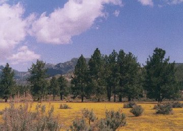
Ganz im Gegensatz zum "komfortablen"
Wüstenklima von Palm Springs ist es längs des California
State Highway 74 hinter dem ca. 3300 m hohen Mt. San Jacinto
ausgesprochen frisch. Blühende Almen, kühles Bergseewasser und
wunderschöne Ausblicke in diesem südlichen Teil des San Bernadino
Forest bilden einen unerwarteten Kontrast zu dem, was man nur wenige
Meilen zurück in den Desert Cities im Coachella
Valley zu sehen bekam.
*
The Palms to Pines National
Scenic Byway starts on Highway 243 in Banning, leads to the scenic mountain
village of Idyllwild, continues on Highway 74 through Garner Valley, and
ends in Palm Desert. The 67 mile route, in the San Jacinto and Santa
Rosa mountains travels from desert oasis to snow-peaked mountains.
The Indian Vista Overlook and Cahuilla Tewanet
Overlook are two popular stopping points along the route.