Aus Gipsablagerungen entstandener Sand im Lake
Lucero wird vom Wind in nordöstliche Richtung ins Tularosa Basin
getragen, wo sich die bis zu 15 m hohen Wanderdünen
des
White Sands National Monument
bilden. Auf ihrem Wanderweg verändern sie stetig ihre Form. Der
Dünologe ;-) unterscheidet hier vier Dünentypen:
Dome dunes, Barchan dunes, Transverse dunes und Parabolic dunes.
Genaueres, auch in deutscher Sprache:
![]()
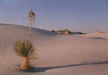
*Great wave-like dunes
of gypsum sand have engulfed 275 square miles of desert and have created
the world's largest gypsum dune field. The brilliant white dunes are ever
changing: growing, cresting, then slumping, but always advancing. Only a
few species of plants grow rapidly enough to survive burial by moving
dunes.
The soaptree yucca can
elongate its stem to keep its leaves above the sand, growing upward as much
as a foot per year.